Blog
Automate Jobsite Mapping and Inspections with OpenSpace, DroneDeploy, StructionSite, Cupix
2023-08-15 in Virtual Tours
Gleb Osipov, 3DTour.ae
Table of contents
- • Introduction
- • Insta360 Construction Kit
- • OpenSpace
- • DroneDeploy
- • StructionSite
- • Matterport
- • Cupix
- • Unified 3D Spatial Digital Twin Platform
- • Conclusion
Introduction
Are you tired of manually mapping and inspecting jobsites? Do you want to streamline your workflow and increase efficiency? Then automation is the way to go! Jobsite mapping and inspections require a lot of time and effort. Traditionally, this involved using measuring tapes, cameras, and checklists to gather data, which was then transferred to drawings and reports manually. This process was not only laborious and prone to errors but also time-consuming. Nowadays, with the advent of automation tools, this process has become much simpler. Automation tools use advanced technology such as 360-degree cameras, drones, and AI-powered software to capture and process data. This saves time and reduces errors, thereby increasing productivity and efficiency. There are several automation tools available in the market today. Each tool has its own set of features, capabilities, and benefits. Some of the popular automation tools for jobsite mapping and inspections are Insta360 Construction Kit, OpenSpace, DroneDeploy, StructionSite, Matterport, Cupix, and Unified 3D Spatial Digital Twin Platform. Insta360 Construction Kit is a 360-degree camera and workflow software package that enables users to capture, edit and share jobsite data in real-time. It is easy to use and integrate with other software tools. It also provides accurate and consistent results that can be viewed remotely. OpenSpace is a 360-degree visual documentation and analysis tool that uses AI-powered computer vision to continuously capture photographic data of jobsites. It is easy to use and provides automatic understanding of the jobsite along with scheduling and tagging features. DroneDeploy is a cloud-based software platform that uses drones to capture high-resolution imagery and generate maps and 3D models of jobsites. It provides accurate and up-to-date maps and models that can be used for virtual inspections and progress tracking. StructionSite is a 360-degree documentation and project management tool that uses AI-powered software and cameras to capture and process data in real-time. It is easy to use and integrates with other software tools. It also provides detailed insights into the jobsite that can be used for performance analysis. Matterport is a 3D imaging and virtual reality platform that can create interactive 3D models of jobsites. It provides detailed information about the jobsite that can be used for inspections and documentation purposes. The virtual tour feature helps stakeholders remotely visualise the progress of the project. Cupix is a cloud-based 3D reconstruction platform that uses 360-degree cameras to capture and process data. It provides a simple and intuitive interface for inspection and documentation purposes. The platform can also be used for virtual walkthroughs and remote collaboration. Unified 3D Spatial Digital Twin Platform is a cloud-based software platform that uses advanced technology such as Lidar and photogrammetry to create accurate 3D models of jobsites. It provides a centralised hub for all construction data that can be used for inspections, progress tracking, and data analysis. In conclusion, automation tools have the potential to revolutionise the jobsite mapping and inspections process. By streamlining workflows, reducing errors, and increasing productivity, these tools are transforming the construction industry. Choosing the right automation tool for your needs can make all the difference.
Insta360 Construction Kit
Introduction: The construction industry is increasingly leveraging technology to enhance productivity, efficiency and safety. One area that has seen significant advancements in recent times is jobsite mapping and inspections. This process used to involve manual identification and documentation of all elements on the construction site, which was time-consuming and prone to errors. However, with the advent of automation tools such as the Insta360 Construction Kit, OpenSpace, DroneDeploy, StructionSite, Matterport, Cupix, and the Unified 3D Spatial Digital Twin Platform, this process has become more streamlined, precise and reliable. Insta360 Construction Kit: The Insta360 Construction Kit is a feature-rich solution that empowers users to capture 360° images, videos and grow renderings of worksites. Its compact size and intuitive interface make it an easy tool to use. It also features one-click editing and easy integration with industry-standard software. Overall, the Insta360 Construction Kit provides an easy-to-use tool that captures exceptional images and offers numerous benefits for jobsite mapping and inspection. Features and capabilities: The Insta360 Construction Kit features a compact size with two 360° cameras, integrated GPS, and a built-in battery that enables all-day usage. It can also capture videos of up to 8K resolution and features stable image stabilisation, making it ideal for capturing images and videos even in challenging environments. Its software integration capabilities allow users to upload and process images in industry-leading platforms such as Autodesk, Revit, SketchUp, and other third-party tools. Ease of use and integration: The Insta360 Construction Kit's user-friendly interface ensures easy operation even for first-time users. It is also built to integrate with a majority of third-party tools for easy data exchange and processing, thus shortening the learning curve. Additionally, the kit provides detailed guides, tutorials, and customer support, ensuring that users can maximise its potential. Benefits for jobsite mapping and inspections: Using the Insta360 Construction Kit in jobsite mapping and inspections enhances productivity and precision. Its ability to capture 360° images and videos offers a more enhanced experience than traditional tools, enabling users to identify even the slightest details. The rendered images provide an accurate representation of the site, reducing the need for repeated visits, and streamlining the work process. Its ability to easily share data with different stakeholders enhances collaboration and decision-making, providing a seamless experience for all parties involved. Overall, the Insta360 Construction Kit is a valuable tool for jobsite mapping and inspections. Its easy-to-use interface, powerful features and integrations make it an optimal choice for anyone looking to upscale their construction site mapping and inspection processes.
OpenSpace
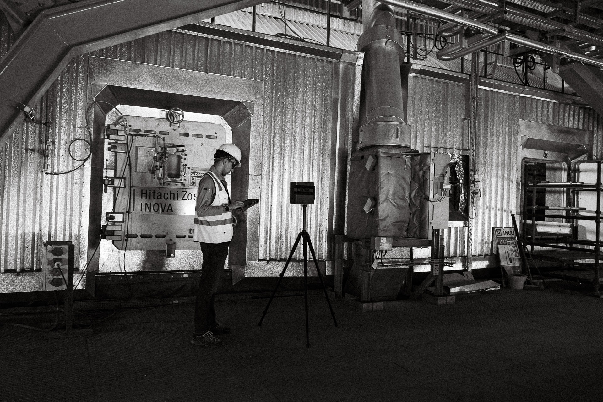
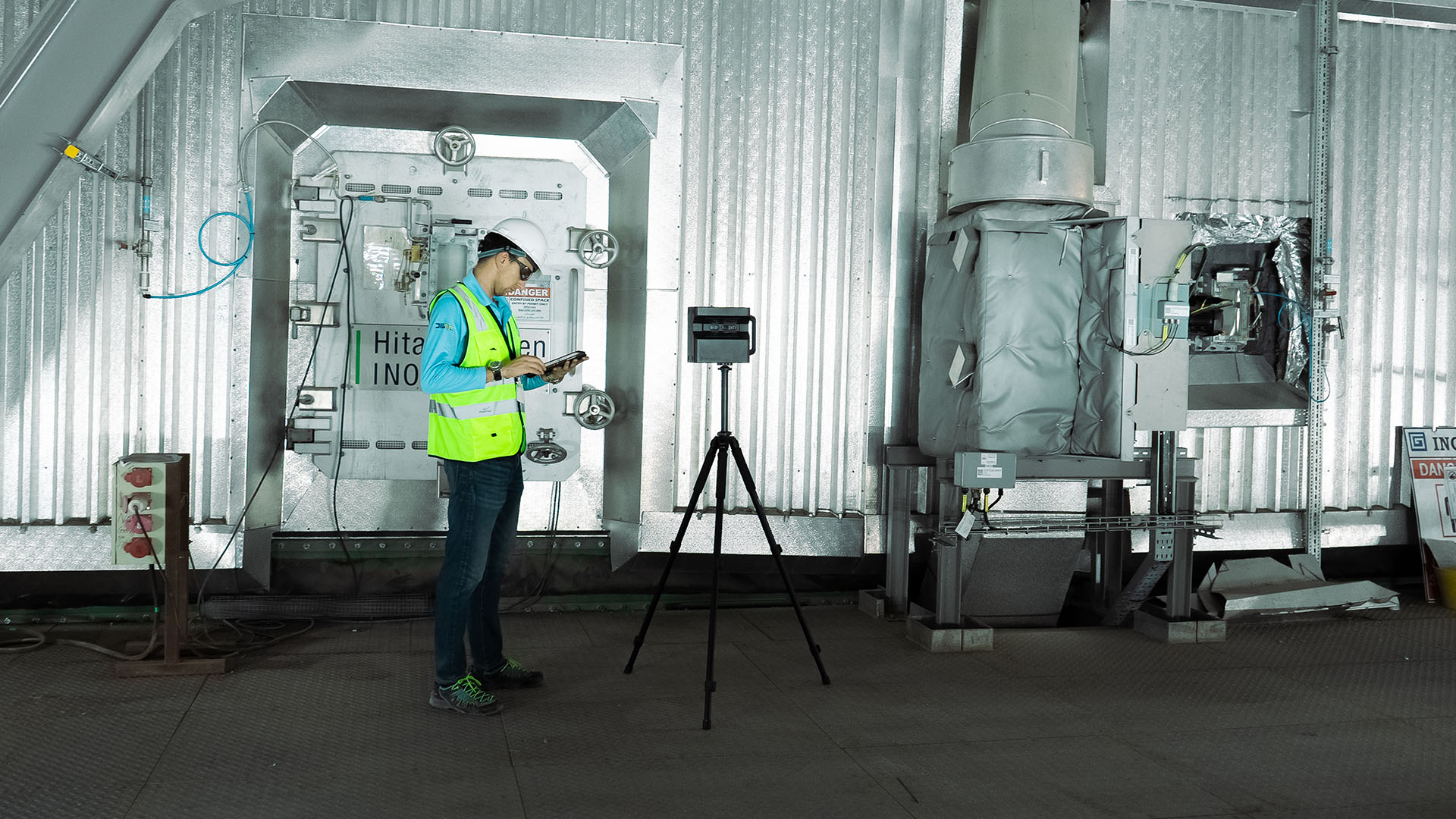
OpenSpace is an incredible tool designed for jobsite mapping and inspections. Its features and capabilities include generating automatic and interactive 360-degree site documentation, enabling real-time comparisons between the as-built and BIM models, and conducting virtual walkthroughs. OpenSpace makes complex jobsite documentation and inspections easier than ever before. This automation tool is incredibly easy to use and integrate into existing workflows. It requires no specialist equipment or personnel, as all that's required to start scanning and documenting is a 360 camera device. What’s more, its artificial intelligence (AI) system makes it possible to stitch together imagery from different devices used simultaneously. When it comes to jobsite mapping and inspections, there are numerous benefits to using OpenSpace. Its detailed documentation and measurement capabilities lower job site risk while increasing efficiency and productivity. It provides stakeholders and clients with a realistic navigable view that complements conventional establishment plans and elevations. When working with OpenSpace, you are guaranteed to save time and money as it prevents the need to return to the site to verify any issues in question. It also streamlines communication between different teams and helps identify potential problems before they become larger issues. Overall, OpenSpace is an excellent tool for job site mapping and documentation that enhances communication and data sharing across the board.
DroneDeploy
DroneDeploy is a cloud-based platform that offers a complete solution for automated mapping and inspections using drones. With its advanced features and capabilities, DroneDeploy makes it easier to capture, process and analyze aerial data in real-time, making it ideal for jobsite mapping and inspections. One of the standout features of DroneDeploy is its ease of use and integration with multiple drones, cameras, and sensors. With intuitive flight planning and autonomous flight options, DroneDeploy reduces the need for manual piloting of drones, significantly improving efficiency and safety. DroneDeploy also provides built-in support for a wide range of drone platforms, including DJI, Yuneec, and Parrot. DroneDeploy's capabilities extend beyond automated flight planning though, with a powerful image processing engine, users can create professional maps and models, detect changes in terrain, monitor progress and identify potential problems. One of the most significant benefits of DroneDeploy is that it provides a bird's eye view of the entire worksite, enabling stakeholders to make informed decisions and coordinate more effectively. By leveraging DroneDeploy, construction companies can identify areas of concern, track progress, and get an accurate picture of the job site with ease. Overall, DroneDeploy offers an all-in-one solution for jobsite mapping and inspections, helping construction teams save time and gain better situational awareness.
StructionSite
StructionSite is a jobsite mapping and inspection tool that uses 360-degree cameras to capture progress and changes on a construction site. Its features and capabilities include automatic progress tracking, 360-degree photo documentation, and 3D site visualization. The 360-degree photos can be used for virtual walkthroughs, quality control, and safety inspections, making it a versatile tool. One of the benefits of StructionSite is its ease of use and integration. It works with existing 360-degree cameras and can be used on both iOS and Android devices. The captured data can be uploaded to the cloud and accessed from anywhere, making collaboration between different teams much easier. This can save time and money by reducing the need for multiple site visits and allows for quicker decision-making. Another benefit of StructionSite is its ability to streamline the jobsite mapping and inspections process. With automatic daily progress tracking, it is easier to identify issues and areas that require attention, allowing for quicker problem-solving. This also helps to ensure everyone is on the same page and aware of the current status of the project. Overall, StructionSite is a powerful tool that can help with jobsite mapping and inspections. Its features and ease of use make it a valuable asset for construction teams looking to streamline their workflows and improve communication. With its ability to simplify the jobsite mapping and inspections process, construction teams can focus on completing their projects on time and within budget.
Matterport
Matterport is a 3D mapping solution that offers high-quality scans of jobsites. The platform has a range of features and capabilities that make it a trusted tool for professionals. Matterport's HD camera captures detailed images that are linked together to create an immersive 3D walk-through of a construction site. The platform is also incredibly easy to use and integrate, making it a go-to choice for many construction workers. With the ability to capture images quickly and efficiently, Matterport saves professionals a lot of time that can be used for other tasks on the jobsite. Additionally, the ability to easily share scans with team members or clients keeps everyone up-to-date on the status of a project. Matterport's benefits for jobsite mapping and inspections are numerous. One major advantage is that the platform captures data from above, below, and at ground level, providing a comprehensive view of the jobsite. This allows for the detection of construction errors early on, saving time and money in the long run. Matterport can also be used to create accurate floor plans, provide documentation for progress tracking, and support remote teams who need to view a jobsite without physically being there. Overall, Matterport's features, ease of use, and benefits make it a valuable tool for automating jobsite mapping and inspections. Its ability to capture detailed images quickly and efficiently saves time and money while ensuring construction quality is maintained at a high level.
Cupix
Cupix is a cloud-based platform that offers users to create a 3D digital twin of their jobsites. It offers a range of features and capabilities that make it an ideal choice for jobsite mapping and inspections. Cupix is easy to use, and as you would expect, this software offers an easy integration process. With its 3D image capturing capabilities, Cupix leads the way in producing accurate and fast 3D renderings of any given site. The smart solution produces a visual replica of sites, thus making it one of the most preferred solutions for construction sites. The software's intuitive approach to jobsite modeling and mapping also allows for users to draw, measure, and annotate while navigating in 3D virtual space. The emphasis on automated jobsite inspections is essential when using Cupix. With its advanced computer vision, the software allows you to pinpoint any defects or problems in the construction site, making it easier to resolve any incidents that may arise during the job. As one of the most affordable options available, Cupix doesn't fall short in delivering value for money as compared to competitors. It is fast and efficient in delivering high quality 3D and panoramic images and videos. Even a non-technical person can use it without much training. Cupix is designed to support any smart device, which is a great advantage for team collaborations, overseeing and sharing of data. It offers a virtual experience of the job site that is quite similar to viewing the location in person. With its top-of-the-range features, Cupix has set the bar high for jobsite mapping and inspections.
Unified 3D Spatial Digital Twin Platform
Unified 3D Spatial Digital Twin Platform: Unified 3D Spatial Digital Twin Platform is a cutting-edge automation tool that leverages the power of AI and Machine Learning technology to digitize physical assets in real-time. It enables construction teams to create a digital twin of their construction project that can be accessed from anywhere, at any time. With Unified 3D Spatial Digital Twin Platform, you can monitor the progress of your construction project remotely and in real-time. The tool's advanced features enable you to track multiple data points, including site layout, project models, and progress data, all in one place. The tool is easy to use and integrate into your existing workflow, making it an excellent addition to your construction project management toolkit. You can use it to improve collaboration, minimize project delays and errors, and enhance the overall construction project management process. But perhaps the most significant benefit of the Unified 3D Spatial Digital Twin Platform is its ability to automate jobsite mapping and inspections. It facilitates the creation of 3D models that provide a bird's eye view of the construction site in real-time. This feature enables construction teams to identify potential issues before they become critical, thereby reducing the need for manual inspections. So if you're looking for an automation tool that can help you improve your construction project management process, you may want to consider the Unified 3D Spatial Digital Twin Platform. With its advanced features, ease of use, and benefits for jobsite mapping and inspections, it is an excellent addition to any construction project management toolkit.
Conclusion
Congratulations! You are now equipped with knowledge about automation tools that ease the jobsite mapping and inspection process. With the right tool, you can enjoy significant benefits in your construction project, including reducing costs, accelerating project delivery, and improving site safety. However, to maximize these benefits, it is crucial to choose the right automation tool for your needs. Before choosing, assess your project requirements, budget, and team’s technical expertise. Remember, the automation tool you choose should complement your current workflow and not create additional problems. In conclusion, the construction industry has embraced automation technology, leading to a more efficient and productive worksite. It’s time to say goodbye to the traditional approach of data collection onsite. Explore these automation tools, identify which of these are the best fit for your specific project needs, and see the improvement in your construction project in no time!